Gunnar Almevik reflects on his time at Snow Hill, and the impact of the location on his work and thoughts on heritage
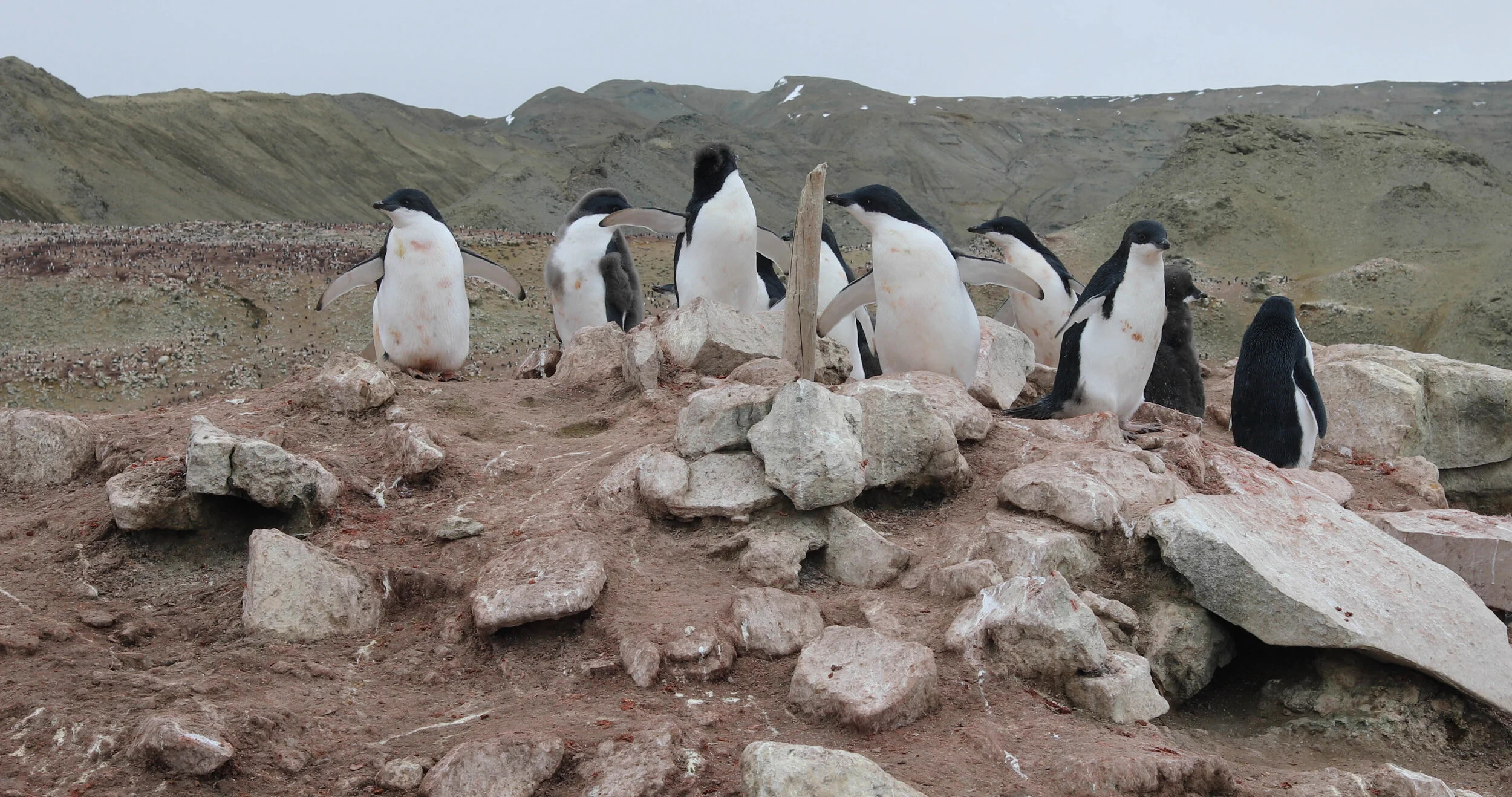
We came to Snow Hill Island and the winter station the 11th of January and left the 24th. The preparation in Sweden involved archival studies and review of documentaries and previous studies, and I expected that the sensation to being there would just confirm what we've learnt. On the contrary, the encounter was extraordinary. The place really struck me. Personally, the sentiment had nothing to do with the hegemonic narrative of great men, adventure and hardship, nor the critical aspects of heritage as means of national identity and territorial sovereignty. The affordance of the place brought me a persisting feeling of vulnerability. The small wooden house draped in tarred felt exposed in the tremendous Antarctic landscape was like in the song of Violeta Parra, 'Como el musguito en la piedra' ("Like moss on a stone" Volver A Los 17). Ambiguously, the knowledge of the transformation of the landscape with melting glaciers and erosions of the earth, the house seemed also like an intruder and statue for the Anthropocene. The house stands on a peculiarly undulated small hill close to the sea in front of the seep moraine slopes of the mountains. In photos from 1902 the glacier fronts runs along the shore and surrounds the location of the building site. Today the glaciers fronts are far away and the ice-covered sea-shore is now open water. The hill on which the building stands is steeper and totally surrounded and undermined by intricate streams of meltwater. One may ask, who is the moss and who is the rock?

View of the site: note the running water from the mountain glaciers. Photo: Gunnar Almevik
Just before I took off from Sweden I several local and national media interviewed me. I got the seemingly obvious question; Why do we need to preserve these remote buildings and remains that almost nobody have the possibility to visit and experience? I remember that I answered the question, not how, and I still carry it with me unrequited. I know though why I’m here. I am here on the mandate from Swedish National Heritage Board with the mission to document and do a condition survey of the remains from the Swedish South-Polar Expedition led by Otto Nordenskjöld 1901-1903. The winter station at Snow Hill Island, which the Argentinians call Casa Suecia (Sverigehuset) de Cerro Nevado, is the main remaining element from the expedition.
Documenting the landscape and the house has involved various technologies. My colleague from the University of Gothenburg, Jonathan Westin, has done laser scanning and together with Dag Avango, extensive drone-based photogrammetry. One objective with the documentation is also to communicate a virtual experience or diorama of the place to a broader audience. I have collected about 5000 high-resolution photographs mainly of the building and its close surroundings, later to be processed through a software for photogrammetric triangulation. However, most time I’ve spent doing traditional manual measured drawings along with written accounts. I will tell you something about the more traditional fieldwork methods.
Dag Avango and I started to walk around and get familiar with the place. We started with an octagonal triangulation drawing of the landscape from 1902 made by Otto Nordenskjöld, Gösta Bodman and José Maria Sobral. We tried to identify their measuring points. Some points were obvious landmarks like the mountain Nunatak in the south or the close by basalt peak. Other points were co-located with the expeditions' meteorological instruments. The discrepancies were obvious, like the locations on the glacier that no longer existed, and the many small laboratory huts once in firm terrain that know were eroded riverbanks. Our process of cartographical re-enactment became a way to know the place, and in a practical sense to think like Nordenskjöld, Bodman and Sobral. Thinking of a transformed landscape.
Dag made up a series of numbers to identify objects of interest in the landscape, and spent several days to describe and photograph these spots. I also filled a notebook with textual descriptions of the house and interiors but most time I spent measuring. Overall, I did 13 drawings with some occasional measuring help from Jonathan Westin. It took me five days. I drew on a transparent plastic film in A3 placed on a millimeter paper and taped on a lightweight board. I used a 2mm HD lead pencil and a scale ruler, and for measuring, I used a two-meter folding ruler and a 50 meters measuring tape. It can rain and snow but my drawing continues.
My first drawing was a map of the site on a 1:200 scale. I used a bearing compass adjusted for use in the South Pole (with a calibration for the magnetism that otherwise bends the arrow downwards), a clinometer for measuring the angle of inclination and a measure tape for the distances. The method was principally the same as the one the expeditioners used in early 1900s. I started to do a polygon around the area from which I could triangulate or aim the details. The polygon had 21 points, and when the last angle and distance was measured, the connection of the first and last failed on three meters. Considering the large area and old school technique, I was content, and distributed the errors some decimeters on each point. It took me about a day to produce.

Drawing Location map with notes from walking interview. Photo: Gunnar Almevik
This manually drawn site map was used in a walking interview with the IAA officials (and friends) Pablo Fontana and Valeria Contissa. Following the object and location number series that Dag Avango made and the literation of my map, we spent an entire day walking through this interview. It was really productive and brought forth new information. Being in a particular physical context evoke memories and narratives that no questionnaire can foresee and that does not emerge in a distal situation of an interview. The physical environment and various objects acts in the narrative. The walking interview directed by and recorded through a graphical representation becomes a method to elicit information from these mnemonic actants.
The building was measured in scale 1:20 from a system of horizontal and vertical reference lines. Due to the methodological interest, I did not use laser distance ranger or leveler but only traditional plumb lead and spirit level. Reference points were marked with chalk liner, and from this fixed system the irregularities of the building was disclosed. The set of drawings included facades, planes and sections, and some details of doors and windows in scale 1:5 and 1:2. I worked another four days with the building drawings.
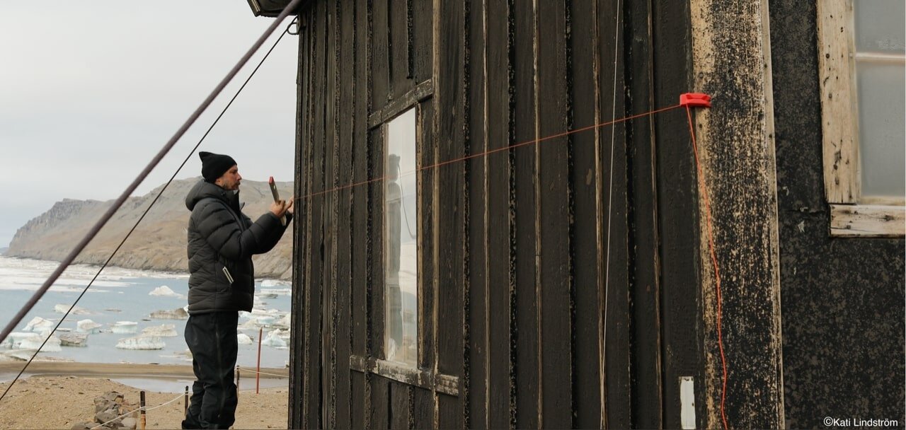
Gunnar at work, measuring the hut. Photo: Kati Lindström
One may consider the relevancy of this traditional method of scale drawing in 2D. When the laser scanner collects a billion measure points in less than an hour, I work several days to collect a thousand. The tip of my pencil compromises the accuracy of centimeters in the static scale drawing, when the laser represent the whole complex environment in dynamic 3D models by the fraction of a millimeter. Still there are advantages that stands out, and not least in an extreme field situation like this. One problem with advanced digital technologies in this field-based situation, with no internet access and limited data power and electric supply and internet access, is that we do not yet know the quality of the data. Strong wind, hard sun, snow and rain affect both laser scanner and photogrammetry while the old school technology still works the same.
The drawing is to me not just a way to produce a graphical representation but also a method for a systematic observation. The practice of drawing evokes a mode of attentive seeing. It forces me into every corner of the house and the process demand of me to consider exactly what to represent. The process of data collection and data analysis is totally integrated. The analysis of the information is made in the field situation, and the result of the graphical representation is produced and handy at the end of the day. It is not a black box. I can directly use the graphical representations in the following condition survey.
Some observations were made essentially through the process of drawing. The irregularities and sag of the building was somehow obvious at sight, but the rationale was not apparent. Firstly, part of the building’s asymmetry is definitely intentional. The length of the building by the sill is 6.40, by the windows 6.30, at the top plate 6.20 and at the ridge 6.10. This inclination of the building was probably from when the timber was cut up in length, potentially already by the workshop in Stockholm who preproduced the modules of the station. One may ask, why? My assumption is that the building’s form by this inclination and without gable eaves becomes streamlined and more sustainable to the strong southern winds. The plane of the building is outlined approximately 25° NNE, which is also the angle that the experienced mountaineer Pablo put up the tents to sustain the southern Antarctic winds. Now when I study the stone refuge of Johan Gunnar Andersson, Toralf Grunden and Samuel Duse here in Hope Bay, it is also outlined at 25° NNE. The entrance door is located towards east.
The house is also deformed in another direction, but this is not intentional. The building lean heavily towards the west, measuring almost 10 centimeters on a distance of four meters. This is quite a lot but although not conspicuous in this context without straight or perpendicular references. I had a theory that I wanted to test and dug a hole on each side of the building. I could verify my suspicion that the depth down to the permafrost was 40 cm shallower on the west side compared to the north. I wondered which impact this could have on the construction, and found a plausible direct causality in the east-side framework. The construction of vertical studs has two top-plates carrying the system of joists and the truss. The plates are jacked into the studs and fastened with two iron nails. As the building is tipping heavily to the west, the top plates on the east side have pulled apart from the studs.
The main aim for to the condition survey is to identify risks and present recommendation of possible actions for safeguarding. Concerning the “Casa Suecia” there are two very different scales to consider. On the one hand it’s the house. The deterioration of materials and even the extensive sag and deformation of the construction are small problems, easily fixed with a jack-screw, some nails iron fittings and some good materials for regular maintenance. On the other hand are the consequences of climate change, with melting permafrost and glaciers causing severe meltwater erosion that will eventually undermine the foundation for the building. What are the possible actions on this scale? Should one drive down tubes to circulate kerosene as a cooler for the permafrost? Should one dig and enforce channels with armed concrete to lead the meltwater around the hut on the hill? Could the building be moved to another secure location? Or, should one just let ‘nature have its course’, and eventually see the old winter station raze into the Weddell Sea? I guess the answers hark back to the journalists’ question, why do we need to preserve these remote buildings and remains that almost nobody have the possibility to visit and experience? Maybe later, I will try to answer this question.